.....or; 'slow, slow, sat nav, slow'!
Our first day off in THREE WEEKS! We had worked hard, and we deserved it. It dawned (for a change) JUST how the weather men said - cold, sharp and clear - PERFECT for walking. There was a sprinkling of snow on the high ground, so I decided we'd do the Castleton skyline walk.
Our first day off in THREE WEEKS! We had worked hard, and we deserved it. It dawned (for a change) JUST how the weather men said - cold, sharp and clear - PERFECT for walking. There was a sprinkling of snow on the high ground, so I decided we'd do the Castleton skyline walk.
Sue had been given a new sat' nav for Christmas, so we turned it on. ( http://uk.youtube.com/watch?v=nWFj3fPLx8I ). We knew the way, but just wanted to see which way it would go. A big surprise was; 'at the end of the road - turn LEFT'????? We ALWAYS turned right, but we let her have her head, and followed the instructions.
I wish someone had told her that it had been snowing;
 I soldiered on, but it WAS very dicey! It's probably a great way to Castleton in good weather, but I think I'd give it a miss on the way home, and go via major roads.
The views across the fields gave us a taste of what was to come. The skies were clear, pristine and bright
 We soon arrived in Castleton, found somewhere to park, and set off.
To say it was cold was an understatement. Sue didn't start to feel her feet for about an hour, and it hurt my teeth to breathe, but that was all just small asides - what mattered were the SUPERB conditions.
A quick look left, and there was Mam Tor - the 'shivering mountain'. http://en.wikipedia.org/wiki/Mam_Tor
 We saw this young Shire horse in the frost and snow.
 The sun, as it rose, came through the trees with a magical light. The fields had that frosty mist on them, the one where you KNOW it's damn cold just by looking at it.
 We walked along the road to Lose hill hall, and set off on the climb to Lose hill.
This track doesn't look steep in the picture, but believe me - it WAS!
 A glance back to the Hope valley revealed the only carbuncle in the area - the Hope cement works.
 Ah well, just keep looking forward then, there were PLENTY of great views today.
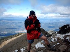
 I had been given a snowman hat for Christmas, so I thought I'd give it an outing.
 It seemed like ages since I'd heard the 'creak' of fresh snow underfoot. Today I was reminded just how much I love that sound. Every footstep brought pleasure!
Looking right, we could see the tip of the Derwent edges.
 But it was time to press on for the top. Sue is just about there in this picture.........
 ....and her reward was this spectacular view along the ridge to Mam tor (left), with Rushup edge beyond, and Brown Knoll to the far right.
 Not many people about today, but I managed to get two walkers in this pic with us!
 The Edale valley, and the southern edge of Kinder Scout. We thought there'd be even more snow up there, but as you can see, not much more than where we were.
 We set off, with huge smiles on our faces, towards lunch at Mam Tor. I had packed my favourite canned soup - Heinz tomato - JUST the thing, with a hunk of fresh bread, to warm the cockles of your heart on a day like today.
 Deep and crisp and even.
 The shivering face of Mam tor, from Back tor.
 Looking back to Back tor.
The old, collapsed road was a sliver of silver with the coating of snow.
 This picture of the sky tells it all, what a GREAT day to be out.
 We eventually reached the top of Mam tor. The sun was now beginning to get lower, and the final hundred feet or so we walked in shadow. NOW you could feel the biting cold eating into even the warmest of clothing.
(We still had another layer though, just in case it got any worse)
 Someone, the Peak Park, I imagine, had added six icons, or pictures, depicting events on Mam tor.


 Again, the Sparrowpit road, like the old road, was picked out in the snow, snaking across the moors.
 Our next destination - the gorge of Winnats pass.
When the old road collapsed the last time, the road up this pass was improved to take the increase in traffic, and the old road was abandoned.
 Come on Sue - get the snow shoes on!
 Looking back to the face of Mam tor in the lengthening evening shadows.
 A solitary vapour trail over Winnats pass.
 The road, as it snakes down the pass.
These limestone cliffs make for a really impressive walk at any time of year, but when there's snow, it's probably at its best.
 You just have to be careful, and watch where you put your feet.
 SUE!! I said CAREFUL!
 Oh, now she's just plain showing off!
 Towards the end of the walk, and this is cave dale.
 Soon, we were surrounded by the smoking chimneys of Castleton, and back at the car.
The light was fading, and the sky was turning pink in the evening glow of the sunset.
It had been a super day, and when we woke the next morning, it was drab and wet, so we felt even better that we had 'stolen' another good day to walk.
We felt it was well deserved!

NEXT POST
CLICK HERE