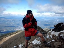
We got out AGAIN last week, but not had chance to do pics until now. We went to the village of 'many ashes' (or Monyash as it's now called) and set off in bright sunshine and shorts (at this point, remember the adage 'ne'er cast a clout 'till May is out).
This tells you all about the village of Monyash, a ten minute drive from our cottage. This is where the walk started from. If you click on the picture, it will enlarge and enable you to read it more easily.
This tells you all about the village of Monyash, a ten minute drive from our cottage. This is where the walk started from. If you click on the picture, it will enlarge and enable you to read it more easily.
 The village green and church, with the lovely daffodils standing proud. We're really looking forward to the next 'event' in the calendar - the bluebells. There are just a few dotted here and there, but a week or two will see them at full strength.
 The village pub 'the Bulls Head', taken at a jaunty angle (lying on the floor).
No - I HADN'T been for a pint beforehand!

Looking back across the pond to the church as we walk out of the village.

 Lots of lambs in the fields, the air was full of their bleating - lovely!
 A lovely sight, but look at the sky - this was a short time before the snow came. At this point it was getting cooler, but we had NO IDEA what was coming in the next 15 minutes!
It was a blizzard, and a very fierce one too which lasted for about 40 minutes. Luckily, we carry all the gear, but even so we had to shelter behind a wall from the driving snow, and even with two pairs of gloves on, I was losing the feeling in my fingers (that's the reason I didn't get the camera out for a mid-blizzard shot).
 It may have been cold, but the flowers knew that spring was on the way, Celendine clumps were everywhere - next stop, the BLUEBELLS!
 After the amazing snow storm, the sun came back out with a vengeance, and in no time at all, the snow had melted and the land was STEAMING.
 This is an old rail line (google 'high peak trail' and 'parsley hay').
There's cafe in this old station building, and we had a welcome cup of hot tea. It took a while, but we thawed out and continued the walk.
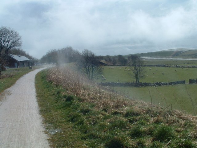 NOW look at it - a lovely day.
 It may have been cold, but the flowers knew that spring was on the way, Celendine clumps were everywhere - next stop, the BLUEBELLS!
 After the amazing snow storm, the sun came back out with a vengeance, and in no time at all, the snow had melted and the land was STEAMING.
 This is an old rail line (google 'high peak trail' and 'parsley hay').
There's cafe in this old station building, and we had a welcome cup of hot tea. It took a while, but we thawed out and continued the walk.
 NOW look at it - a lovely day.
You know what they say - if you don't like the weather in England, wait five minutes, it'll change!
(Or is that Scotland??)

 On the last leg of the walk, we passed a smallholding with lots of strange animals on, probably one of these 'rare breeds' places. This pair of Emus looked like a right pair of bookends!
 This Llama was really inquisitive, but I never trust them as I've seen how far they can spit!
 As we drove back to home, one more picture of the sky tells a story - just LOOK at it!

 On the last leg of the walk, we passed a smallholding with lots of strange animals on, probably one of these 'rare breeds' places. This pair of Emus looked like a right pair of bookends!
 This Llama was really inquisitive, but I never trust them as I've seen how far they can spit!
 As we drove back to home, one more picture of the sky tells a story - just LOOK at it!
You can see the rain straight ahead - and Bakewell and our home is in that dip!
Sure enough, when we got home, the rain was hammering down but at least we were now warm and cosy inside. Hope it's nicer next week - I should then have some pictures of the bluebells.

NEXT POST
CLICK HERE